Werewolf
Underminer
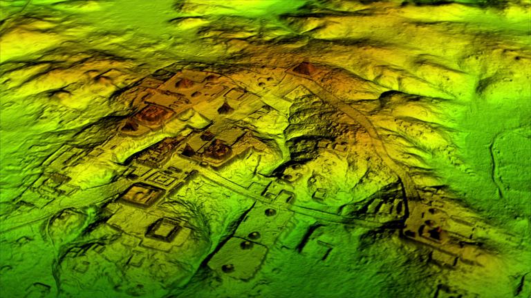
I've posted this before (Mysteries & Paranormal board), but it's worth having here too. The use of airborne LIDAR (Light Detection and Ranging) to scan where ancient cities once stood. This often uses infrared light (but can also use visible or UV) - the shorter wavelength provides higher resolution and can see through a jungle canopy. This produces a detailed topographic map that allows artificial features to be identified.
Example: Scientists find 60,000 Mayan structures preserved under dense Guatemalan jungle
Example: Scientists find 60,000 Mayan structures preserved under dense Guatemalan jungle
Researchers using a high-tech aerial mapping technique have found tens of thousands of previously undetected Mayan houses, buildings, defence works and pyramids in the dense jungle of Guatemala's Peten region, suggesting that millions more people lived there than previously thought.
Researchers used a mapping technique called LiDAR, which stands for Light Detection And Ranging. It bounces pulsed laser light off the ground, revealing contours hidden by dense foliage... The 2,100 square kilometres of mapping detected about 60,000 individual structures, including four major Mayan ceremonial centres with plazas and pyramids.